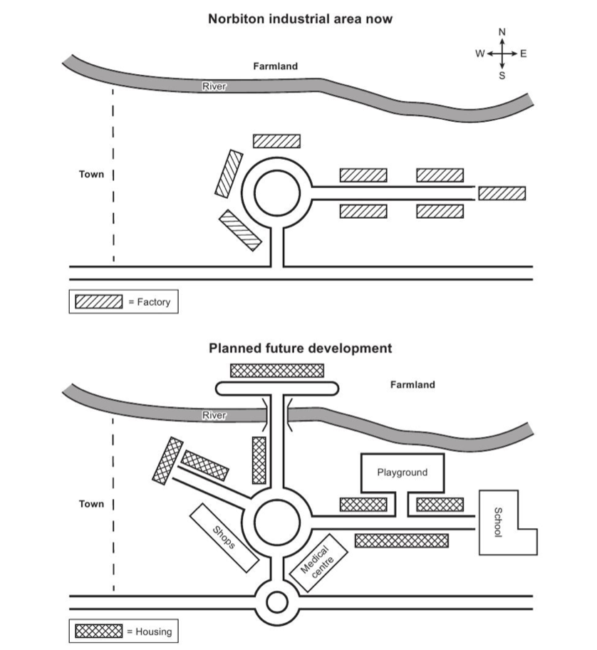
The maps below show an industrial area in the town of Norbiton, and planned future development of the site.
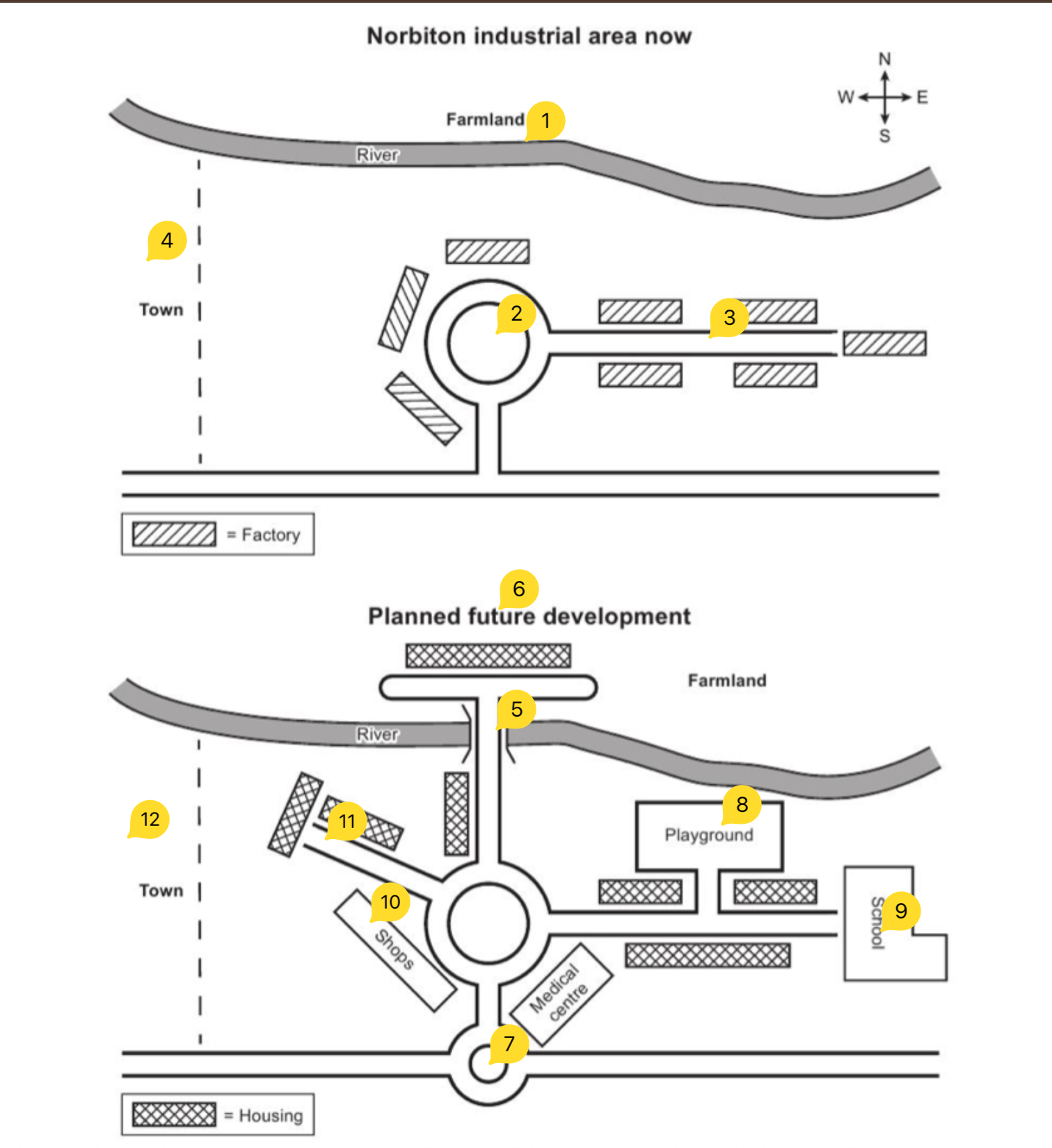
The maps below show an industrial area in the town of Norbiton, and planned future development of the site.
Summarise the information by selecting and reporting the main features, and make comparisons where relevant.
The provided two maps depict how the Norbition industrial area will be change after planned development plan.
Overall, it can be seen that, the Norbition industrial witnessed a dramatic change after implementation of anticipated development, such as river divided, attach to new small ring road and factories converted to housing.
Looking at the first map, a large river is location in the north side, which touch the town in west side of the map. In the middle of the map, a central ring road showed up, which lead two roads toad east and sound side respectively. There are eight factories surrounded to ring road as well as road which run to east side. Behind the river there is a farmland.
Looking at the second map, the Norbition industrial will undergo a striking change. On the north side of the map, river is decided by a t-shape road, which is a extension of central ring road. Three facilities, school, medical center and a playground added on the east side of the ring road. Shops has opened on the south-west corner of the ring road. New road has developed to connect north-west side of the Norbition industrial area. All factories witnessed transformation, factories converted to housings in east side road, new houses also constructed to beside new t-shape road and north-west road. The farmland and town are remain unchanged in future development plan.