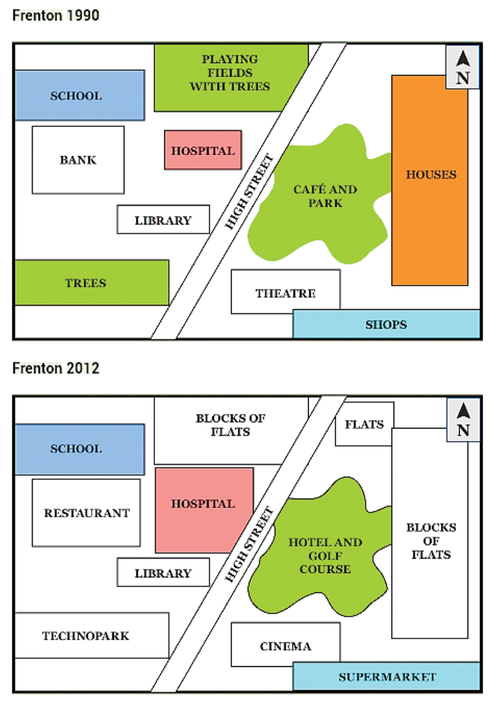
The maps below illustrate how Frenton changed from 1990 to 2012
Map analysis
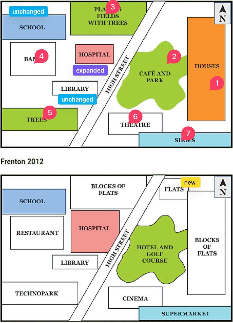
The pair maps show the anticipated changes of Frenton to be undergo by the year 2012.
Overall, it can be seen that the Frenton town witnessed some transformation, renovation over the period shown.
Looking at the first map in more details, in East-Center there were houses. A high street intersect the whole area in two part, just east side of the road area is occupied by a cafe and park. In Center-North side a playing field with trees almost attached to the start of high street. In front of playing field, a hospital is showing up. Near to the Hospital, on north center there is also a Bank. Finally on the bank of the high street road, which is on south side of the map, there is a area occupied by trees.
The map of the Frenton after proposed changes, looks distinctly different. The houses is expected to be changed with blocks of flats, along with this that close cafe and park is anticipated to transform in hotel and golf course. The hospital of the middle didn't change rather it renovated and expanded. The tree area of first map's south-west is removed and trurned to a technopark. After the school, the bank changed to restaurant. School and library remain untouched, whereas flats developer on the north-east.